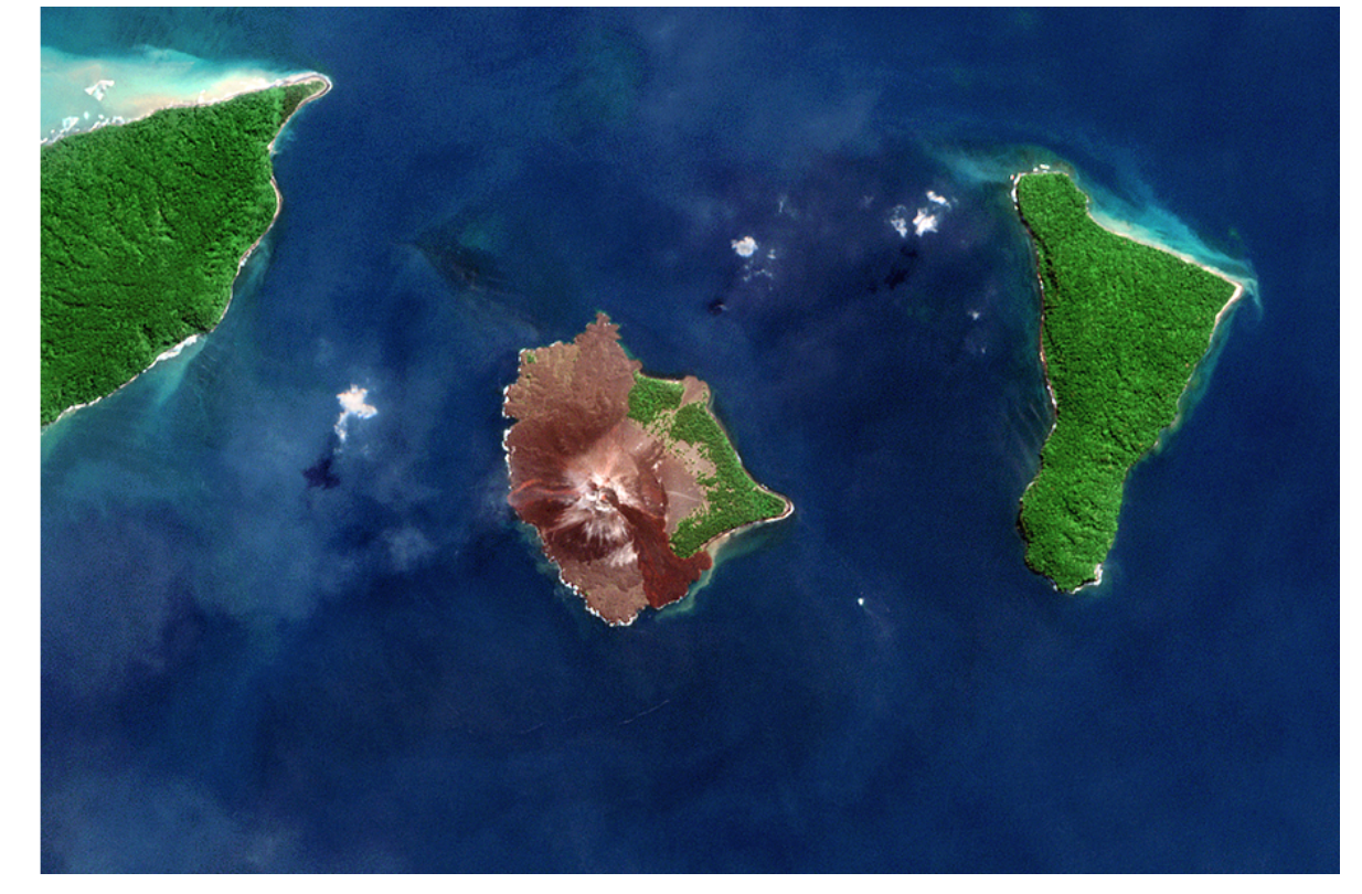

Anak Krakatau before its 2018 eruption.
AI-Collected Data on Volcano Behavior Explodes as Threats Increase
Forty years ago this week, Mount Saint Helens erupted and sent ash all the way around the planet and killed 57 people in that nearby area of Washington State. Now apps keep track of volcanic eruptions and earthquakes, showing a recent uptick of these events in the past few years.
A story on Nature.com by Jane Palmer explains how AI is being used to monitor volcanos worldwide. She starts with the eruption of Anak Krakatau in 2018 and the tsunami it generated that killed 450 people on nearby coasts of Java and Sumatra. Although nobody foresaw that disaster, a 2019 study found that satellite and ground-based instruments had picked up precursory signals that could help forecast similar events in the future at Anak Krakatau and other peaks.
The unexpected collapse at Anak Krakatau shows some of the challenges for researchers have in monitoring thousands of potentially dangerous volcanoes around the world. But advances in the field, such as AI algorithms to review the data being collected, may lead to better forecasting of eruptions.
The Mt. St. Helens eruption was actually the beginning of the era of tracking volcano data closely. Scientists had flocked to the mountain in the months before the blast and had carefully tracked its behavior, including frequent earthquakes, gases fuming from its crater, as well as an ominous bulge in its northern area.
“It was the first really significant eruption that was captured by modern-day scientific instrumentation,” says Seth Moran, scientist-in-charge at the US Geological Survey (USGS) Cascades Volcano Observatory in Vancouver, Washington. “And so, in a lot of ways, it’s become a benchmark for the ways that people go about looking at volcanoes around the world.”
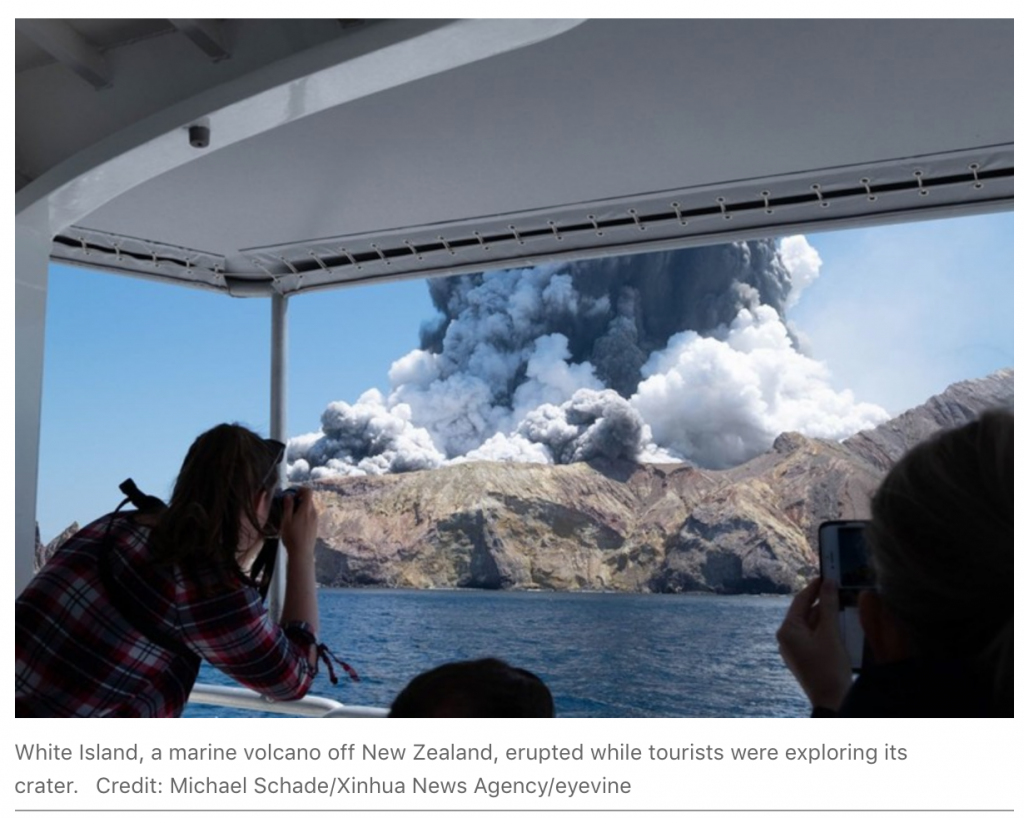
Palmer’s article goes deep into describing volcanos that have erupted around the world, from Stromboli and Etna in Italy to a 2010 eruption in Iceland.
The researchers’ original motivation for developing the system was to find a way to detect eruptions at unmonitored volcanoes because even remote blasts can have far-reaching impacts. The eruption of Eyjafjallajökull in Iceland in 2010 created an ash plume that disrupted air traffic across Europe for weeks.
“As volcanologists, we always used to say that we were data poor,” says Michael Poland, scientist-in-charge at the USGS Yellowstone Volcano Observatory in Vancouver, Washington. “But now the satellite data really expand our ability to see what volcanoes are doing.”
Researchers have combined radar data with satellite observations that record temperature and sulfur dioxide emissions to capture a full snapshot of what happens before and during eruptions. A study of the 47 most active volcanoes in South America, which used 17 years of satellite data, showed that changes in at least one variable, and sometimes in all three, precede an eruption.
To better use the data, researchers created a volcano-monitoring platform called MOUNTS (monitoring unrest from space), using data from Sentinel satellites and ground-based earthquake information that monitor 17 volcanoes, including Anak Krakatau.
As they started on the project, however, the researchers faced a new and unusual problem — too much data. The satellites provide torrents of readings, more than researchers can analyze using conventional methods.
In response to this challenge, researchers have turned to machine-learning techniques, a form of artificial intelligence in which computer algorithms such as neural networks can be trained to pick out patterns in data. Juliet Biggs, a volcanologist at the University of Bristol, UK, and her colleagues have created a neural network that has churned through some 30,000 Sentinel-1 images of more than 900 volcanoes and flagged about 100 images as needing more attention. Of those images, 39 showed real ground distortions5, meaning that the AI system had reduced the workload for the volcanologists by a factor of nearly 10. Now, they are testing their system on some half a million images from more than 1,000 volcanoes.
“You just can’t look at every image,” Poland says. “I see machine learning as having a real impact in filtering through these massive volumes of data.”
The article is rich in facts and interesting ties between how satellites and AI and upgraded the whole science of volcanology.
read more at nature.com


Leave A Comment